Drone Services
powered by the Unmanned Aerial Systems (UAS) Team
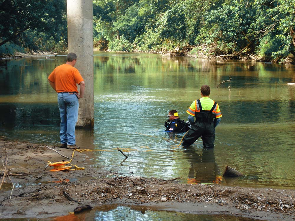
USI’s UAS Team is at the forefront of remote sensing technology, offering unparalleled inspection, surveying, and marketing solutions. Leveraging advanced thermal, high-resolution zoom, and photogrammetry technologies, we provide safe, efficient, and swift services for clients seeking optimal value from their assets. Especially when a project is unique, hazardous, or time-sensitive, we deliver precise data tailored to your specific objectives.
Our team proudly features four FAA-certified drone pilots strategically positioned across the state and a certified thermographer.
Our UAS Team customizes services to accommodate the unique needs of our clients. Just some of what we can deliver includes:
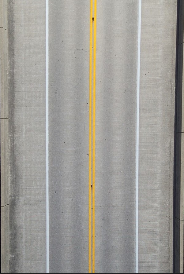
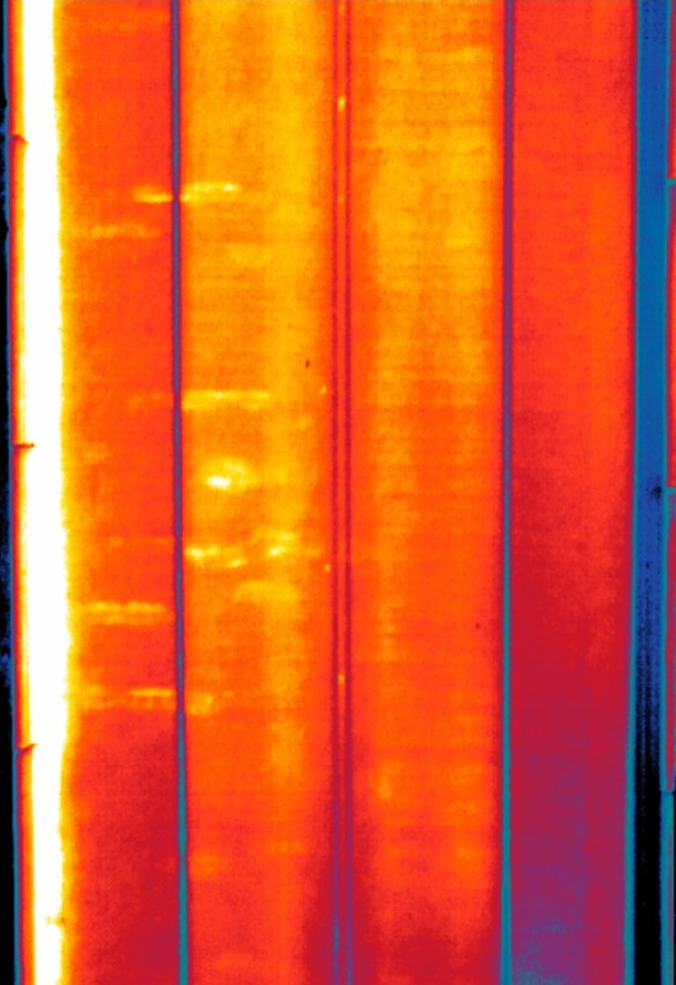
- Engineering Assessment reports that spotlight unseen deficiencies through thermal data analysis.
- Accurate volume calculations for stockpile and borrow pit materials.
- Cinematic-grade aerial marketing photographs and videos that accentuate the value of any asset.
- Inspection-grade photo and video documentation, minimizing ladder time to pinpoint deficiencies, thereby enhancing safety.
- Survey-grade point cloud data, contour line SHP files, 3D models, and refreshed aerial imagery for rapid assessment of expansive areas.
Are you interested in learning more about how USI’s UAS Team can help you? Would you like to set up a services demonstration? Reach out through the form below and we’ll get back to you.